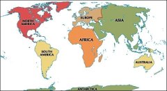
Navigace mapy Celťho Svžta online: KliknutŪm a taěenŪm na mapž Celťho svžta, nebo pouěijte zoom kontrol.
ZemžpisnŠ öŪÝka: | 0,8167 (0į49'0.001"N) |
ZemžpisnŠ dťlka: | 33,4667 (33į28'0.120"E) |
NadmoÝskŠ vżöka: | 1 068 m |
|
| |
|
|
|
|
GMT Ťas: +3 hodin | Posun oproti »R: +2 hodin |
VzdŠlenost mžsta Itanda do 25 nejvžtöŪch mžst stŠtu: Uganda (cestopis)
VzdŠlenost mžsta: Itanda do Top 10 mžst svžta

???? ???????
?? ?????? ??????????????? ? ?????????? ???????, ??? ??????? ???!
????? ??????????
??? ?????? ????????? ????????, ??? ???? ???????? ?????????? ?????!
IQ ????
? ??? ?? ?????? ?????? ???? ?? IQ (???? ?? ?????????) ?????????!
???? ?? ??????? ????
???? ?? ?????? ?????????? ???? ?? ??????, ????????????, ???????, ?????, ?????, ?????, ????????, ???????, ?????????, ???????
???????????? ?????
???????? ???? ?? ?????? ??????????? ? ?????????, ???????? ???? ?????? ?? ?????????
?????????? ??????? ?????? ??????????
?????????? ??????? ?????? ??????????. IQ ???? ?????? 30 ????? ? ???????? 40 ??????? ????????
???? ?????????? ?????? ????????
?????????? ??? ?????????? ???????????? ????? ??????, ???????? ??????????? ????????
???? ?? ???????? ??????
???? ?? ?????? ???????? ?????? ?? ???????? ????????? ???????? (???)
????: ???????? ??????
???????? ???? ?? ?????? ????????????? ?????. ??????? ????? ?????? ???????? ? ????? ???????
Eng ·
–ė–ļ–ĺ–Ĺ–ļ–į –Ĺ–į –í–į—ą Web ·
–ö–Ĺ–ł–≥–į –Ņ–ĺ—Ā–Ķ—ā–ł—ā–Ķ–Ľ–Ķ–Ļ
·
RoboStav
Copyright (c) 2026 by Topglobus.ru. –í—Ā–Ķ –Ņ—Ä–į–≤–į –∑–į—Č–ł—Č–Ķ–Ĺ—č!


