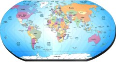
Navigace mapy Celťho Svžta online: KliknutŪm a taěenŪm na mapž Celťho svžta, nebo pouěijte zoom kontrol.
ZemžpisnŠ öŪÝka: | 49,7667 (49į46'0.120"N) |
ZemžpisnŠ dťlka: | 17,0833 (17į4'59.880"E) |
NadmoÝskŠ vżöka: | 259 m |
|
| |
|
|
|
|
GMT Ťas: +1 hodin | Posun oproti »R: 0 hodin |
VzdŠlenost mžsta Pinke do 25 nejvžtöŪch mžst stŠtu: »eskŠ republika - »esko (cestopis)
VzdŠlenost mžsta: Pinke do Top 10 mžst svžta

?????????? ???? ?????????
??????????? ?????????? (????. IQ ó intelligence quotient) ó ?????????????? ?????? ?????? ?????????? ????????
???? ?? ????????? ? ??????? ????
????????????, ???????, ?????, ????, ????, ????, ???????, ??????, ?????????, ???????, ???????? ????????
???????? ????? ??
???? ?? ?????? ???????? ?????? ?? ???????? ????????? ???????? (???)
???? ?????????? ?????? ????????
?????????? ??????? ????? ?????????? ??????, ??????? ?? ??????? ?????? ??????????? ???????????????? ?????? ?????
????? ????? ????
?? ?????? ???? ????? ??????? ? ???? ?????? ???? ??????????? ??????? ?? ??????
???? ??????????? ???????????
???? ????? ??????? ????? 5 ????? ? ????? ????????? 50 ???????
??????? IQ ????
? ??? ?? ?????? ?????? ???? ?? IQ (???? ?? ?????????) ?????????!
???? ?? ?????????: ??????????
??? ?????? ????????? ????????, ??? ???? ???????? ?????????? ?????!
??????? ? ???????? ??????
???????? ???? ?? ?????? ???????? ??????????. ??????? ????? ?????? ???????? ?? ???????, ???? ?????????? ??????? ?? ?????
Eng ·
–ė–ļ–ĺ–Ĺ–ļ–į –Ĺ–į –í–į—ą Web ·
–ö–Ĺ–ł–≥–į –Ņ–ĺ—Ā–Ķ—ā–ł—ā–Ķ–Ľ–Ķ–Ļ
·
RoboStav
Copyright (c) 2026 by Topglobus.ru. –í—Ā–Ķ –Ņ—Ä–į–≤–į –∑–į—Č–ł—Č–Ķ–Ĺ—č!


