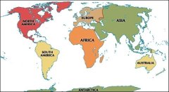
Msto: Rehnice, Region: Stedoesk Kraj

Zpt na lnek: esk republika - esko (cestopis)


Navigace mapy Celho Svta online: Kliknutm a taenm na map Celho svta, nebo pouijte zoom kontrol.

Zempisn ka:

50,4000 (5023'60.000"N)

Zempisn dlka:

14,8500 (1450'60.000"E)

Nadmosk vka:

262 m

lnek: esk republika - esko (cestopis)

Nejvt msta: esk republika - esko (cestopis)

Foto, fotky: esk republika - esko (cestopis)

vechna msta: esk republika - esko (cestopis)

Frum: esk republika - esko (cestopis)

Nejvt msta svta

GMT as: +1 hodin

Posun oproti R: 0 hodin

Vzdlenost msta Rehnice do 25 nejvtch mst sttu: esk republika - esko (cestopis)

Pm vzdlenostKm
 Rehnice - Praha  45 km
 Rehnice - Brno  185 km
 Rehnice - Ostrava  253 km
 Rehnice - Plzen  128 km
 Rehnice - Olomouc  194 km
 Rehnice - Liberec  43 km
 Rehnice - Ceske Budejovice  160 km
 Rehnice - Hradec Kralove  74 km
 Rehnice - Melnik  56 km
 Rehnice - Usti Nad Labem  65 km
 Rehnice - Pardubice  78 km
 Rehnice - Havirov  262 km
 Rehnice - Zlin  241 km
 Rehnice - Kladno  60 km
 Rehnice - Most  86 km
 Rehnice - Karvina  270 km
 Rehnice - Frydek-mistek  261 km
 Rehnice - Opava  224 km
 Rehnice - Karlovy Vary  140 km
 Rehnice - Decin  62 km
 Rehnice - Chomutov  101 km
 Rehnice - Teplice  76 km
 Rehnice - Jihlava  123 km
 Rehnice - Prerov  214 km
 Rehnice - Prostejov  193 km

Vzdlenost msta: Rehnice do Top 10 mst svta

Pm vzdlenostKm
 Rehnice - Praha  45 km
 Rehnice - Berln  256 km
 Rehnice - Londn  1 054 km
 Rehnice - Los Angeles  9 560 km
 Rehnice - Moskva  1 624 km
 Rehnice - New York  6 583 km
 Rehnice - Pa  917 km
 Rehnice - Peking  7 410 km
 Rehnice - Rio De Janeiro  9 943 km
 Rehnice - Sydney  16 055 km
 Rehnice - Tokio  9 030 km


Eng · Иконка на Ваш Web · Книга посетителей  · RoboStav
Copyright (c) 2025 by Topglobus.ru. Все права защищены!

 IQ тест онлайн

Игры онлайн